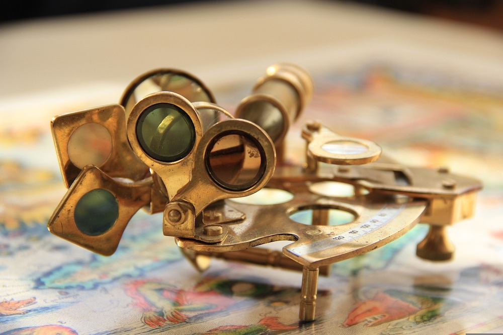
The Naval Academy stopped teaching its notoriously difficult celestial navigation course in 2006, ending a tradition that had lasted more than 100 years, since 1845. The reason for the removal? The Navy determined that the hard-to-learn skill was irrelevant in an era when GPS technology can so simply locate a vessel at sea.
But then things changed.
History of Navigation: The Basic Tools of Seafaring
Celestial navigation is the use of stars, the sun, moon, and planets to plot out directions from one place to another. The process dates to at least the time of the ancient Polynesians and was used for millennia to help seafarers get from one place to another. In fact, the practice was in place until the middle of the last century; that’s how reliable it is.
Additionally, lithographic nautical charts were long used to navigate the seas. Unfortunately, the government stopped printing them in 2013, but for those who are interested, they continue to be available as free, downloadable PDFs through National Oceanic and Atmospheric Administration (NOAA).
But can those older approaches partner with today’s technology?
The Future: Everything Old Is New Again
While lithographic charts still aren’t being printed, the US Naval Academy has decided to return celestial navigation to its list of required courses. Celestial navigation theory was again on the schedule in the summer of 2015, and the class of 2017 was the first in more than a decade to graduate with knowledge of how to navigate by the stars.
Why the shift?
Between commercial GPS jammers and increased cyber threats, the Navy realized that some good, old-fashioned approaches might be in order. Teaching celestial navigation provides an additional layer of confidence to seamen and ensures they have a backup when technology isn’t available. Granted, most of today’s Navy continues to rely on GPS systems, but they have sextants available if needed.
Projections: A Blend of Old and New Is Best
While a sextant and celestial navigation allow accuracy of about 1.5 miles, GPS can get you within feet of your destination. Therefore, it’s highly unlikely we’re going to ditch GPS altogether and go back to print-out maps and sextants. However, having multiple tools at the ready means that ships are much more likely to make it to their final destination, regardless of what technology issues arise.
Celestial Navigation and So Much More
At Cyclone Shipping, we naturally use electronic methods as a freight forwarder, but we know how to use celestial navigation as well. We also maintain a nautical focus on every shipment—because we believe in using all the available tools. That’s how we deliver the highest accuracy with the fewest errors.
Whether it’s navigating around the world or handling your freight forwarding, sometimes looking out the window (the Exxon Valdez oil spill could have been avoided if the officer had just looked out the window), plotting your position, and using all tools is the safest bet.
At Cyclone Shipping, we care for each shipment in a safe, timely, and cost-effective manner. You can expect five-star service where our eyes are always open, we focus on every detail, and we leave nothing to chance. Contact us to learn more.


